Some images of stark Martian landscapes provide visual appeal beyond their science value, including a recent scene of wind-sculpted features from the High Resolution Imaging Science Experiment (HiRISE) camera on NASA's Mars Reconnaissance Orbiter.
 Image credit: NASA/JPL-Caltech/Univ. of Arizona
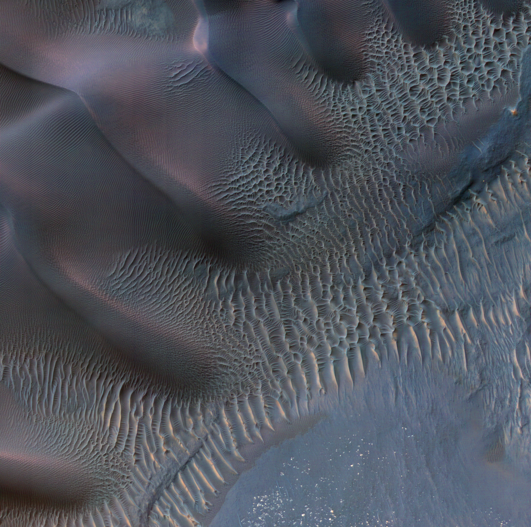
The scene shows dunes and sand ripples of various shapes and sizes inside an impact crater in the Noachis Terra region of southern Mars. Patterns of dune erosion and deposition provide insight into the sedimentary history of the area.
 Credit: NASA/JPL/University of Arizona
The Mars Reconnaissance Orbiter has been examining Mars with six science instruments since 2006. Now in an extended mission, the orbiter continues to provide insights about the planet's ancient environments and about how processes such as wind, meteorite impacts and seasonal frosts are continuing to affect the Martian surface today. This mission has returned more data about Mars than all other orbital and surface missions combined.

Credit: NASA/JPL/University of Arizona
More than 20,600 images taken by HiRISE are available for viewing on the instrument team's website:http://hirise.lpl.arizona.edu . Each observation by this telescopic camera covers several square miles, or square kilometers, and can reveal features as small as a desk.
HiRISE is operated by the University of Arizona, Tucson. The instrument was built by Ball Aerospace & Technologies Corp., Boulder, Colo. The Mars Reconnaissance Orbiter project is managed by the Jet Propulsion Laboratory, Pasadena, Calif., for NASA's Science Mission Directorate, Washington. JPL is a division of the California Institute of Technology, also in Pasadena. Lockheed Martin Space Systems, Denver, built the spacecraft.
For more information about the Mars Reconnaissance Orbiter, see http://www.nasa.gov/mro .
Contacts and sources:
Guy Webster
Jet Propulsion Laboratory, Pasadena, Calif.Partially Written by: Alfred McEwen and Ginny Gulick
This enhanced-color image shows sand dunes trapped in an impact crater in Noachis Terra, Mars. Dunes and sand ripples of various shapes and sizes display the natural beauty created by physical processes. The area covered in the image is about six-tenths of a mile (1 kilometer) across.
Sand dunes are among the most widespread wind-formed features on Mars. Their distribution and shapes are affected by changes in wind direction and wind strength. Patterns of dune erosion and deposition provide insight into the sedimentary history of the surrounding terrain.
Sand dunes are among the most widespread wind-formed features on Mars. Their distribution and shapes are affected by changes in wind direction and wind strength. Patterns of dune erosion and deposition provide insight into the sedimentary history of the surrounding terrain.
The scene shows dunes and sand ripples of various shapes and sizes inside an impact crater in the Noachis Terra region of southern Mars. Patterns of dune erosion and deposition provide insight into the sedimentary history of the area.
Sand dunes are among the most widespread aeolian (wind-formed) features present on Mars. Their spatial distribution and morphology are affected by changes in wind direction and wind strength. Patterns of dune erosion and deposition provide insight into the sedimentary history of the surrounding terrain.
This image shows sand dunes trapped in an impact crater in Noachis Terra. Dunes and sand ripples of various shapes and sizes, such as in this enhanced-color subimage, show the natural beauty created by physical processes.
This image shows sand dunes trapped in an impact crater in Noachis Terra. Dunes and sand ripples of various shapes and sizes, such as in this enhanced-color subimage, show the natural beauty created by physical processes.
The Mars Reconnaissance Orbiter has been examining Mars with six science instruments since 2006. Now in an extended mission, the orbiter continues to provide insights about the planet's ancient environments and about how processes such as wind, meteorite impacts and seasonal frosts are continuing to affect the Martian surface today. This mission has returned more data about Mars than all other orbital and surface missions combined.
Credit: NASA/JPL/University of Arizona
More than 20,600 images taken by HiRISE are available for viewing on the instrument team's website:http://hirise.lpl.arizona.edu . Each observation by this telescopic camera covers several square miles, or square kilometers, and can reveal features as small as a desk.
HiRISE is operated by the University of Arizona, Tucson. The instrument was built by Ball Aerospace & Technologies Corp., Boulder, Colo. The Mars Reconnaissance Orbiter project is managed by the Jet Propulsion Laboratory, Pasadena, Calif., for NASA's Science Mission Directorate, Washington. JPL is a division of the California Institute of Technology, also in Pasadena. Lockheed Martin Space Systems, Denver, built the spacecraft.
For more information about the Mars Reconnaissance Orbiter, see http://www.nasa.gov/mro .
Guy Webster
Jet Propulsion Laboratory, Pasadena, Calif.
0 comments:
Post a Comment